The Flight Route
What You'll See From the Sky
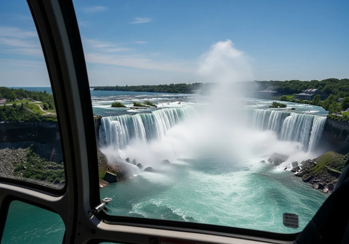
The 12-minute helicopter flight traces about 27 km up the Niagara River, past the Whirlpool and the gorge, then sweeps over all three waterfalls. You'll see American Falls and Bridal Veil Falls on the approach, with the Canadian Horseshoe Falls the showpiece — passed almost directly overhead as the water curls green over its rim.
The Three Falls
Three waterfalls, one flight
Niagara is not one waterfall but three, side by side across the border. From the air you take in all of them in a single loop — here's what to look for.
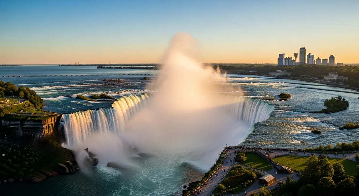
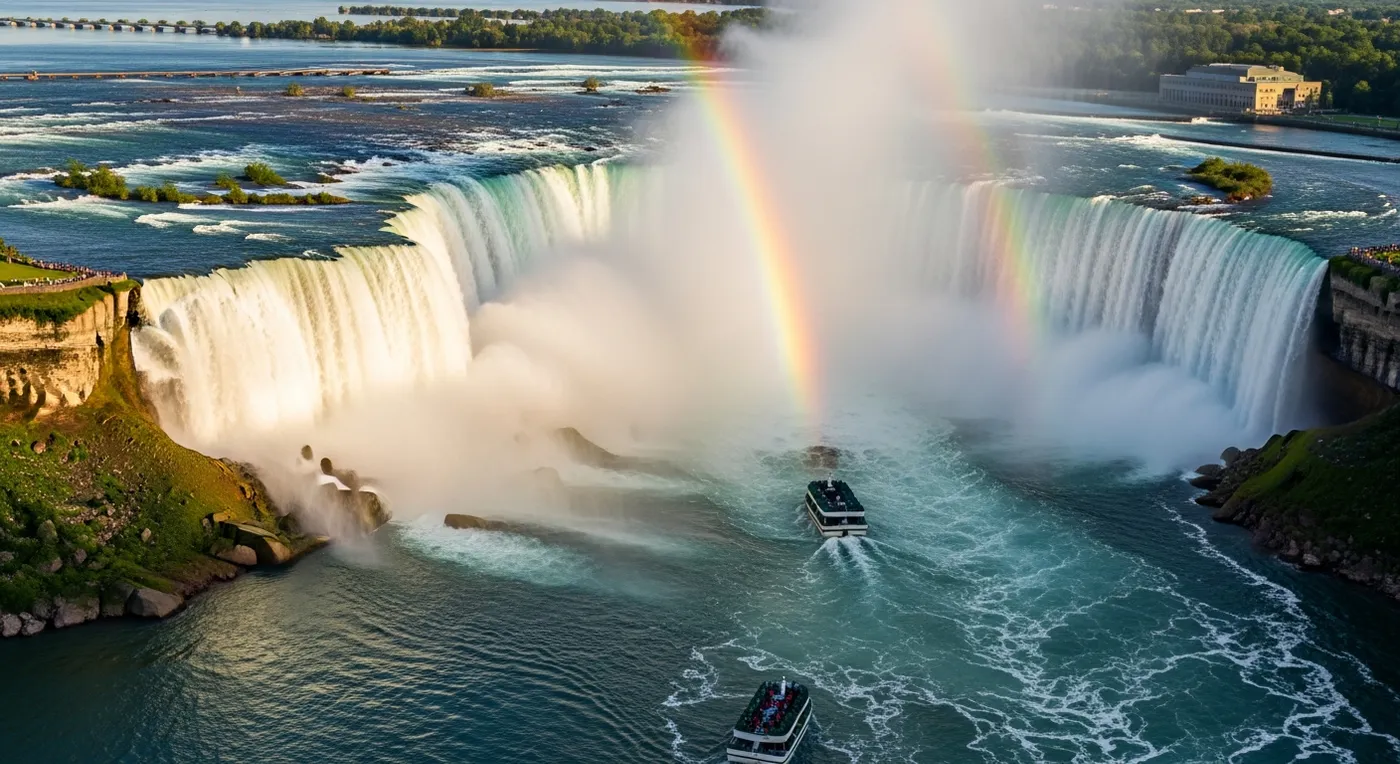
Horseshoe Falls
The showpiece. The curved Canadian falls carry roughly 90% of the river's flow, and you pass almost directly overhead as the water glows deep green over the brink.
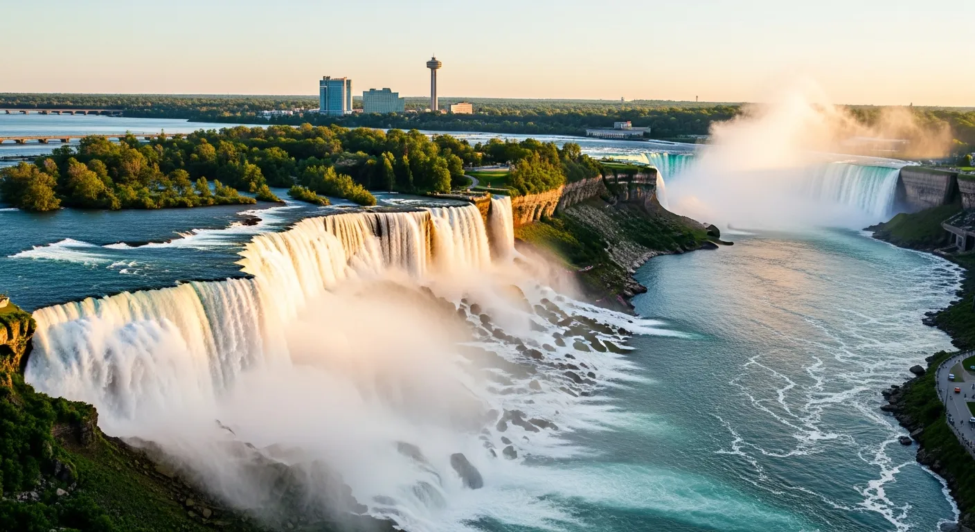
American Falls
The wide, straight curtain on the United States side, dropping onto a jumble of boulders below. From above you see its full length framed by the Rainbow Bridge.
Bridal Veil Falls
The slender third fall, split from American Falls by little Luna Island. It's the hardest to notice from the ground and the easiest to pick out from the sky.
The Route
Your flight route, landmark by landmark
From lift-off to landing, here's every landmark that rolls past your window in order — a full arc up the river and back over the falls.
Victoria Avenue Heliport
Lift-off. The pad sits a five-minute drive from downtown Niagara Falls, and within seconds the city and the river open up beneath you.
Sir Adam Beck Generating Station
The great hydroelectric complex on the lower river, where a slice of the Niagara's power is turned into electricity for the region.
Niagara Parks School of Horticulture
The manicured gardens and tree canopy of the botanical grounds spread out in green geometry along the parkway below.
Whirlpool & Spanish Aero Car
The river makes a dramatic right-angle turn into a spinning green basin. Look for the antique cable car strung high across the Whirlpool.
Whirlpool Rapids
Below the whirlpool the Niagara channels into some of the fastest whitewater in North America, a ribbon of churning rapids cutting through the gorge.
Rainbow Bridge
The elegant steel arch linking Canada and the United States comes into view, the gateway that frames your first look at the falls ahead.
Queen Victoria Park
The long green promenade that hugs the Canadian shore, lined with viewing platforms and gardens right at the water's edge.
American Falls
The first of the three waterfalls, a wide, straight sheet of water spilling onto the rocks below on the United States side of the river.
Bridal Veil Falls
The narrow third fall right beside it, tucked past Luna Island. From this height the two American falls read as one bright ribbon of white.
Horseshoe Falls
The moment everyone waits for. You sweep almost directly over the curved brink of the Canadian falls, with mist rising and, on a clear day, a rainbow across the gorge.
Skylon Tower
The needle-like observation tower rises above the Canadian skyline, giving you a sense of scale for just how high you're flying over the falls.
Lower Niagara River Return
The flight banks north and follows the lower river back toward the heliport, a last unhurried look at the gorge before you touch down.

On a Clear Day
How far you can see
When the sky is clear the view stretches far beyond the falls themselves. Look north and the Toronto skyline rises across Lake Ontario on the horizon. Turn south and the broad blue of Lake Erie fills the distance, feeding the river that becomes the falls.
It's the kind of perspective you simply can't get from the ground — the whole Niagara story, from lake to gorge, laid out in a single sweep.
- Toronto skyline to the north, across Lake Ontario
- Lake Erie filling the horizon to the south
- The full 27 km arc of the Niagara River and gorge
See It For Yourself
Every landmark, in twelve minutes
All three falls, the Whirlpool, the gorge and the skyline — from the best seat in Niagara. Enjoy free cancellation up to 96 hours before you fly.